
Severe Weather Risk Level 4 of 5 for much of Eastern Iowa
Have you noticed it's super warm today? I mean warmer than it has been by a lot! This means the fun of tornado season in the Midwest has officially begun.

According to our partners at KWWL, our listening area is currently at a Level 4 out of 5 risk for severe weather for this afternoon and evening in areas along and south of Highway 20. Northern areas are se at a Level 3 out of 5. All types of severe weather are possible in these conditions.
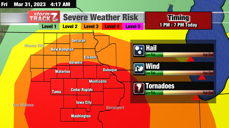
As it stands we have more than enough "ingredients" to make severe weather develop near the cold front as it sweeps in from the west. Storms will likely start to appear near or just east of I-35 around noon to 1pm. These will track to the northeast quickly. Storms have the potential to start as supercells, or rotating storms, capable of producing large hail, tornadoes (some that could be strong and long lasting), and damaging wind gusts. As the storm line continues eastwardly, damaging winds and tornadoes will be the main threat, but should move out of the eastern counties by 7 PM.
Bottom line:
"Widespread severe activity is expected, with some storms capable of being long-lived, widespread, and intense in nature. Tornadoes, some strong and long-tracking, significant damaging wind gusts, and some very large hail initially will all be possible. You may not have a lot of time to seek shelter as storms move very quickly. Timing is from 1 to 7 PM."
-Brandon Libby, KWWL
Keep it safe out there today. We have some time to prepare for the worst and I would take it if I were you. Make sure you have flashlights, filled water bottles, tennis shoes, maybe a snack or 2 all placed in your safest room of your home. Make sure you have some blankets, and any form of communication (phone/laptop/tablet) or radio with you so that you can follow the news and keep up to date should the worst happen. It's always better to be prepared, than sorry.
KEEP READING: What to do after a tornado strikes
LOOK: The most expensive weather and climate disasters in recent decades
More From Eagle 102.3

